Superb trekking in an isolated area of west Nepal, Lower Dolpa is a trek for the real adventure or explorer who is looking for an off the beaten path experience. The focal point of this area is Shey Phoksundo Notional Park. This remote region in western Nepal was opened for foreigner's 1990. Lower Dolpa offers a real opportunities to visit ancient villages, high posses, beautiful lakes, isolated Buddhist monasteries and to experience the vast array of wildlife inhabiting this region of Nepal. Trekking in Dolpa region has its own charm; people here still live a primitive and simple life with enthralling cultures, festivals and traditions. The cultural tradition of this region are closely linked to the Tibetan. The major attraction here is Shey Phoksundo National Park- the biggest national park in Nepal. The scenery is magnificent with the deep blue water of the lake contrasting with the weathered red and brown hills. Trekking in this untamed region offers you a remarkable and worthwhile experience. The snowy peaks, ancient and isolated villages, rich wildlife, high posses, pasturelands and the monasteries are unforgettable. This is one of few areas where pre- Buddhist Bon religions are still practiced with a relience on the use of medicinal herbs, yak farming and trekking.
The trek begins at the STOL airstrip of Juphal after a short flight from the terrain town of Nepalgunj that is well connected by both road and air in Kathmandu. The trail goes over three high passes, the Kagmara La (5115m), Bagala (5090m) and Numa La (5360m) passing the deep -blue tranquil Phoksundo Lake and finally concludes at Juphal descending the gorge side path of Tarap Khola.
Highlights of Kagmara pass Dolpo
One and only place to see Bon religion in Nepal,Cave Civilization, Himalayan view of Annapurna and Dhaulagiri, Home of Thakali and Thakuri.
Transfer to the airport for the flight to Nepalgunj, which lies close to the Indian border in the western Terai.
Today's walk follows the Tila Khola through fields of corn, potato, buckwheat and barley until the valley narrows and we enter a forest of oaks, spruce and maples. We pass through the village of Chotra with typical Tibetan mani walls. After a short distance, we come to another Tibetan-looking village, Naphukana. With a large gompa over looking the village.
From Naphukana the trail becomes steeper and climbs through a forest to a pass named Mauri Lagna [3820m]. From the pass there are views of snowy peaks to the north and east. Descending from the pass, the trail traverses a steep slope before dropping into a forest of pine and oaks. We then enter the Bheri Valley and after following the trail in and out of side valleys, we come to the village of Chaurikot.
Continuing on to the village of Balasa we can see Kagmara peak on the horizon. The trail drops to a stream before climbing through a forest of walnut trees to a ridge. Passing through the apple orchards of Jyakot, we then descend to the village of Rimi before following a rocky trail ' down to the Bheri River,
We stay on the west bank of the Bheri River, passing Hurikot and arrive at the entrance to the Shey Phoksumdo National Park. We then come to the confluence of the Garpung and Jagdula Rivers, which joins the Bheri River Following the Garpung Khola, we reach our camp by the riverside.
We continue to follow the Garpung Khola, ascending slowly towards the Kagmara La. Today is a short trek but it is very important for acclimatization so that we do not ascend too quickly.
We now cross to the eastern side of the river, where the valley narrows and the river become a series of waterfalls. The trail climbs to a moraine below the Kagmara La and we moke our camp among the boulders. We get magnificent views of the surrounding peaks from here.
We get an early start this morning and ascend alongside the Kagmara Glacier to the Kagmara La. This is a good place to spot rare blue sheep. After a 900m descent, we reach the pastures of the Pungmo Khola Valley.
The trail now enters birch and juniper forests which soon give way to blue pine. Up the side valleys, there are views of Kanjirolba peak before we reach the fortress-like village of Pungmo, set amidst barley fields.
We continue downstream to the national park headquarters at Sumduwa before Joining the trail up the Phoksundo Khola to Phoksumdo Lake. We climb through a forest of large cedars to the winter settlement of Palam and continue ascending through the open country to a ridge from which there are good views of the lake in the distance. Close by is a spectacular waterfall, the highest waterfall in Nepal. The trail then makes an initial descent before climbing gently to Ringmo village. After crossing a bridge below Ringmo, the trail continues northwards to the shores of Phoksumdo Lake.
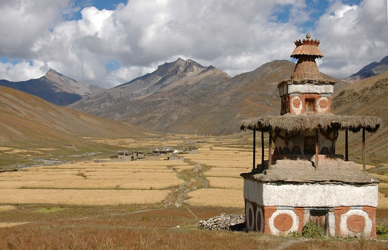
Today is a rest day at the lake which is known for its unusual greenish-blue colouring. It is overlooked on the western side, by a large snowy peak known as Kanjirolba or Kanchen Ruwa. A trail leads through a stand of juniper trees to an old dilapidated gompa which overlooks the lake. As well as Buddhist pointings and statues, there is also evidence of the ancient Bon-po religion within the temple and chapels.
We retrace our route as for as Ringmo and then follow a trail eastwards, through forest of juniper and blue pine. The trail follows the river up the valley to a waterfall until we reach the base of the Baga La.
From our camp it's a steady 3 hour climb to the top of the Baga La, the second of the high passes. The descent is gradual at first but it soon drops steeply to a stream before ascending again to the foot of the Numa La.
We continue climbing through arid country to the last of the high posses, the Numa La. It is marked by mani stones and, if it is clear, we can see as far as Dhaulagiri. The trail now descends post a huge mani wall to the Tarap region and we walk through the barley fields of the Tarap Valley to the settlement of Do.
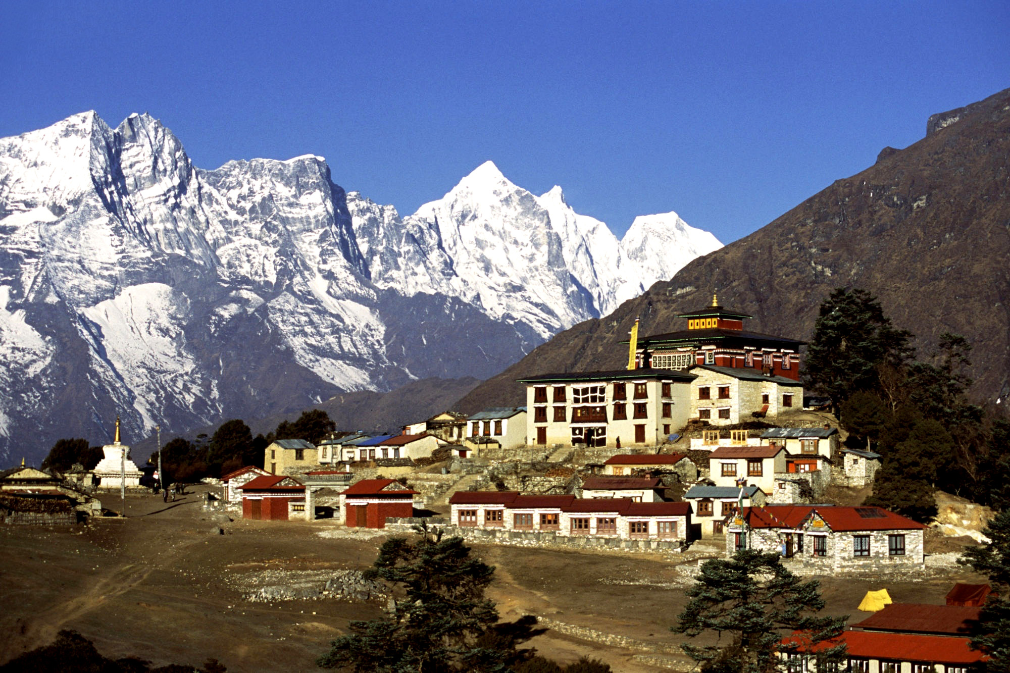
Rest days at Do. It is the largest settlement in Tarap and has several gompas. On the ridge above the village is the Ri Bhunpa Gompa and, just to the east, the village of Shipchhok has a Bon-po gompa which is certainly worth exploring. There are also opportunities to get great views of the valley and surrounding snow peaks from a number of nearby ridges.
This morning's walk is almost level and follows the river until it flows into a gorge. We enter the gorge which has large rose shrubs and other wildflowers, and after crossing and re- crossing the river numerous times, we finally come to a flat expanse.
The trail today is steep, narrow and dangerous as it clings to the cliffs, and the bridges along here can often be washed out Eventually, the valley widens and the route becomes easier as we approach the village of Khanigaon. We then climb high above the river before descending towards the Barbung Khola and the fortress village of Tarakot
We follow the Barbung Khola downstream along the south bonk to the village of Lawan, before crossing to the north bank and walking for several more hours to Dunai.
Today, we trek from Dunai toJuphoL From Dunai we follow the river trail downstream to Juphal. We walk uphill through meadows and pasta few houses to the small hotels at Kola Gaura (2090m), After several hours of walking, we finally reach Juphal, which is the end point of our trek.
We take a flight from Juphal to Nepalgunj. We then take a connecting flight from Nepalgunj to Kathmandu.
The weather can be unpredictable during your trek to Dolpo with Kagmara pass at any time of year, so warm clothes and a good sleeping bag are essential.
Tims card and national park entry permit.
Experienced guide and porter one for two guests.
All ground transportation during the trip.
Three meals a day (Breakfast/Lunch/Dinner) and accommodation in local family house/lodge.
Emergency rescue arrangement.
First aid kit.
Water resistant kit bag.
Walking poles.
High quality Italian camping equipment (Ferino, La Sportiva, Salewa).
Down sleeping bag, Down jacket air mat on request.
Drinks, beverage water
Donations, tips
Personal expenses
Visa fee on arrival